Ground Penetrating Radar (GPR) is a non-invasive geophysical method used to detect subsurface features quickly and accurately. At Pulse Locating, we deploy advanced GPR systems for high-resolution imaging of underground structures, buried utilities, and environmental anomalies. Whether you’re managing civil engineering projects, environmental investigations, or utility mapping, GPR delivers the depth, clarity, and precision needed to reduce uncertainty before you break ground.
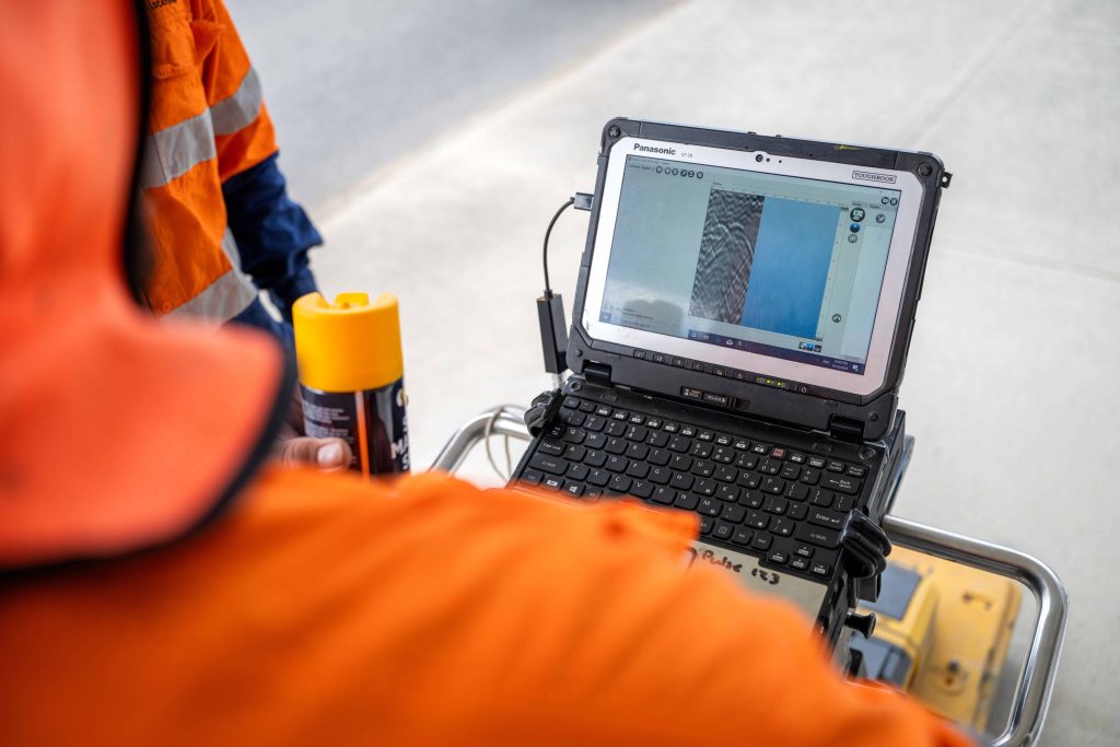
Our GPR investigations allow you to visualise underground conditions in real-time. GPR transmits a series of radar pulses into the ground using a transmitter antenna. When these electromagnetic waves encounter a boundary between materials with contrasting dielectric permittivity (such as soil and metal or rock and water), a reflected signal is returned to a receiving antenna. The GPR system captures this signal, producing data that can be processed into clear cross-sectional images, also known as depth slices, of the subsurface.
These radar signals are sensitive to the dielectric properties of materials, meaning even non-metallic pipes, voids, underground storage tanks (USTs), and buried evidence can be detected without disturbing the surface.
Using antenna frequencies tailored to your project’s depth and resolution requirements, Pulse Locating adapts each survey to site-specific conditions. Lower frequency antennas allow for deeper penetration but less detail, ideal for detecting large structures or deep voids. Higher frequency antennas provide finer resolution, enabling us to identify small targets just a few centimetres below the surface, particularly useful in engineering geophysics and forensic analysis.
Our team works across diverse environments, including sandy soils, high conductivity clays, and urban areas with dense utility infrastructure. In each case, we calibrate our equipment and interpretation methods to match the electrical conductivity of the ground, ensuring reliable data output.
Collecting data is only one part of the process. What sets Pulse Locating apart is the clarity and accuracy of our data interpretation. Our trained geophysical specialists process GPR data using industry-leading software, allowing us to build detailed subsurface maps. These maps are not only valuable insights for engineers and planners, they’re also used for risk mitigation, compliance, and quality control throughout construction or remediation phases.
Our GPR services support a wide range of applications:
Not all sites are alike. High electrical conductivity, moisture content, and varying soil composition can affect GPR signal quality. That’s why our approach is built on adaptability. From fresh water interference to reinforced concrete, our team understands how to work with (and around) the variables that limit traditional radar performance.
Our ability to match antenna frequency and GPR method to the target depth and soil profile means you get results tailored to your project. We often integrate GPR with other geophysical techniques when necessary, offering a multi-method approach to complex ground conditions.
Ground penetrating radar investigations are typically scoped based on survey area, required depth penetration, ground conditions, access constraints and reporting requirements. GPR rates start from $135.00 per hour. Works may form part of a broader subsurface investigation programme or be delivered in response to specific site concerns.
While GPR introduces an upfront investigation stage, it significantly reduces uncertainty prior to excavation or construction. Identifying buried services, voids or subsurface anomalies early can prevent rework, structural damage and costly programme delays that outweigh the initial investment.
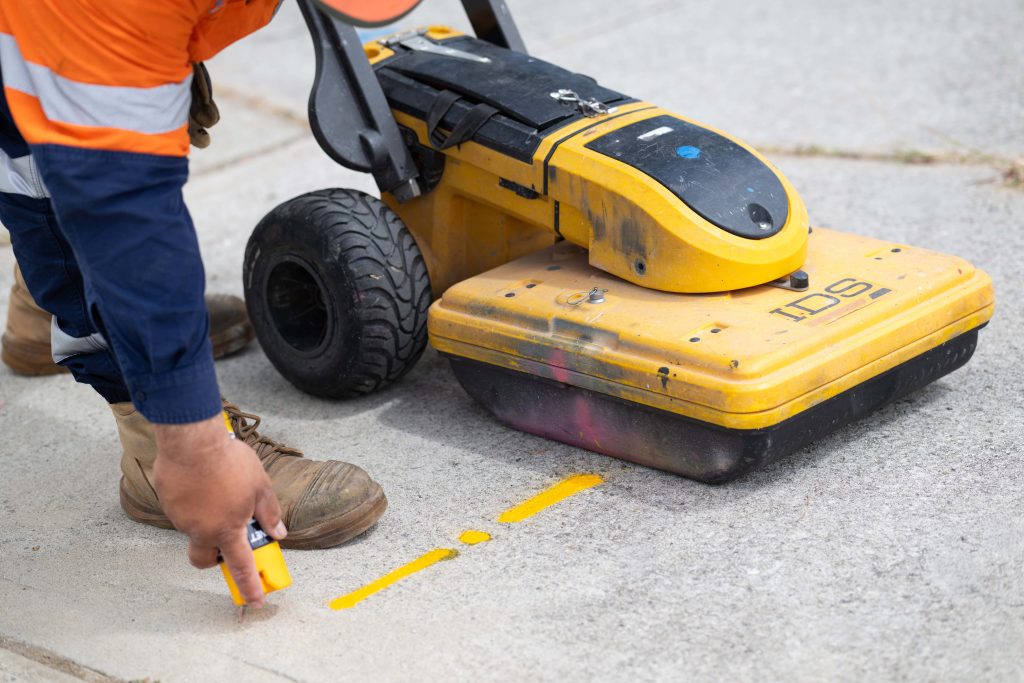
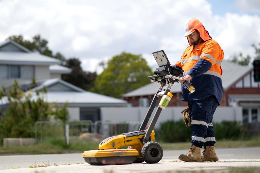
Our process starts with a consultation to understand your site and objectives. We assess target depth, ground conditions, and the scale of investigation required. Once onsite, we carry out GPR surveys using mobile or handheld GPR equipment, guided by a trained technician and monitored through a control unit. Data is collected, validated, and processed into 2D or 3D models, depending on your project’s scope.
You’ll receive a detailed report that includes:
Pulse Locating provides ground surveys to engineering firms, construction contractors, environmental consultants, and asset managers across Australia. Our technicians are experienced in interpreting radar waves under complex conditions, drawing on geophysical research principles and real-world industry practice.
From large-scale infrastructure projects to detailed forensic investigations, our GPR systems deliver data with confidence. The combination of electromagnetic radiation, radar wave processing, and practical engineering insight ensures every survey is actionable and cost-effective.
Ready to identify what’s below before you dig? Contact Pulse Locating today to book your GPR investigation.
Office: +08 6305 0607
General Enquiries: enquiries@pulselocating.com.au
Accounts Queries: accounts@pulselocating.com.au
Career Enquiries: hr@pulselocating.com.au
Office & Mailing Address: Unit 2/30 Achievement Way Wangara, 6065